-
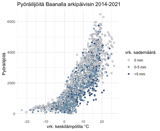
Pyöräilijöitä Baanalla
11.4.2022 -

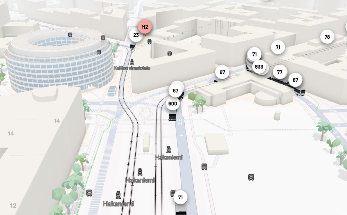
Bussitutka
11.4.2022 -

Stadi3D-lataaja
7.3.2022 -

Helsinki 1800-2030
1.3.2022 -
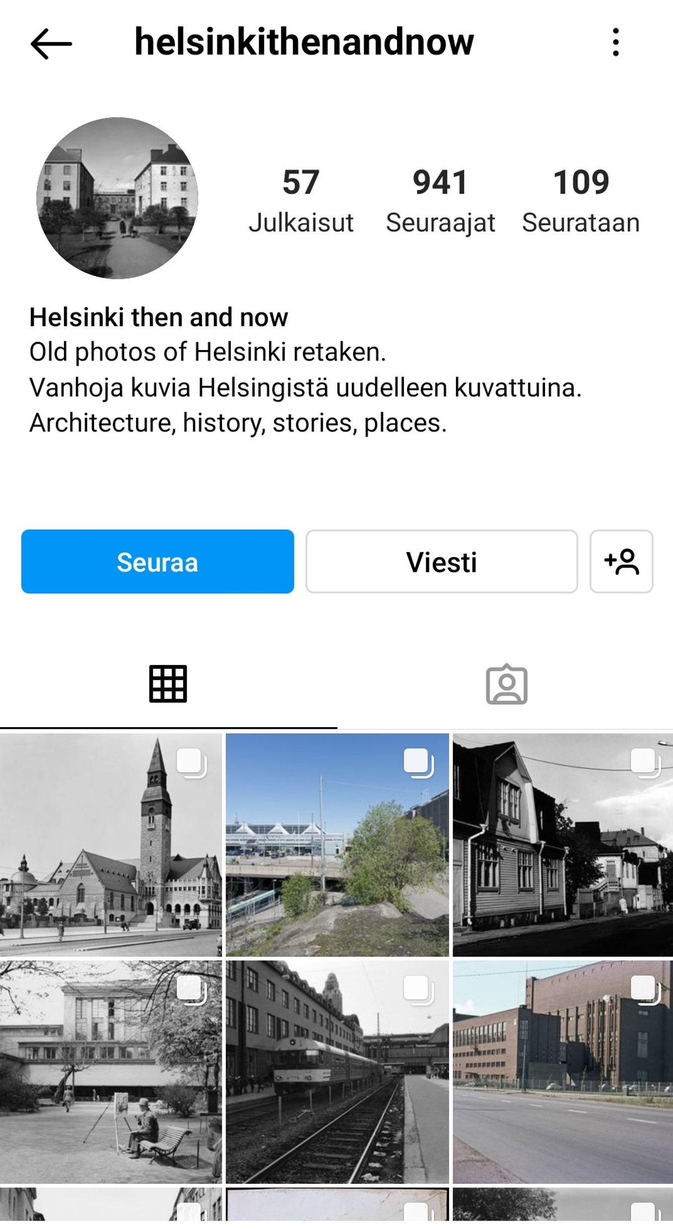
Helsinki then and now
15.2.2022 -

inHelsinki
13.2.2022 -
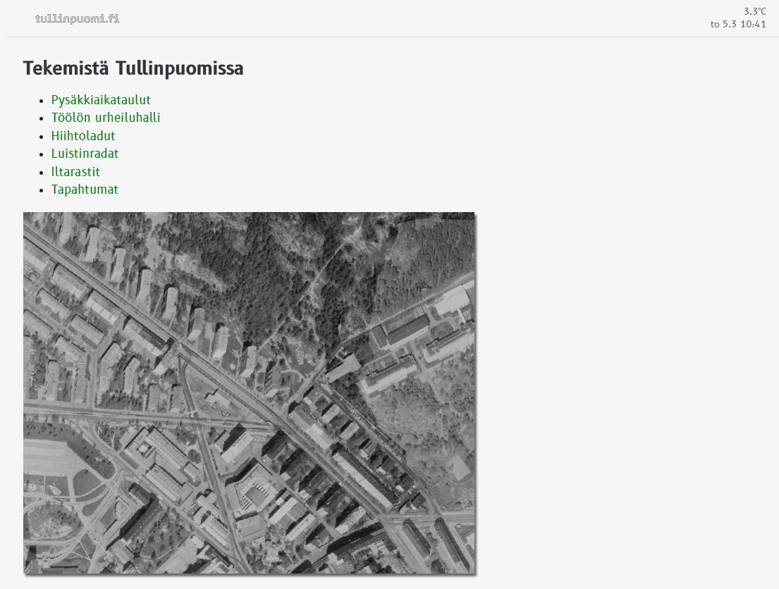
Kiven sisässä
10.2.2022 -

Near Real-Time Semantic View Analysis of 3D City Models in Web Browser
10.2.2022 -
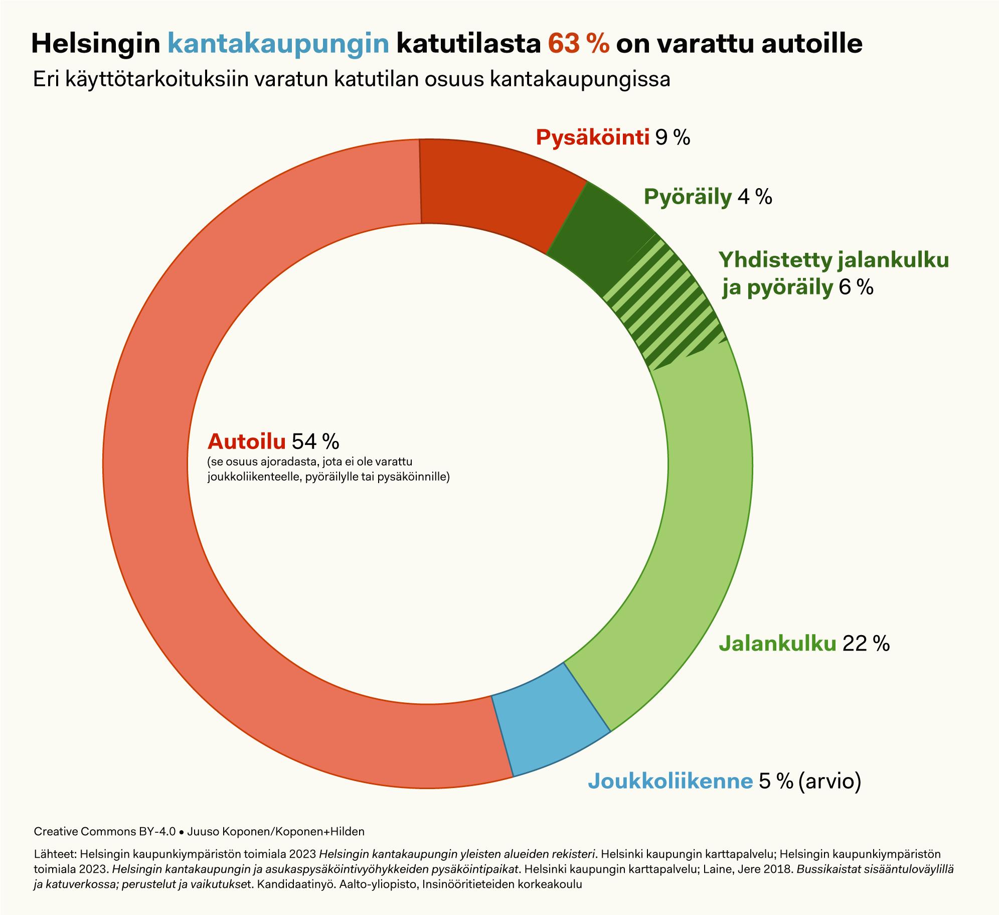
Helsingin kantakaupungin katutilasta 63 % on varattu autoille
30.11.2021 -
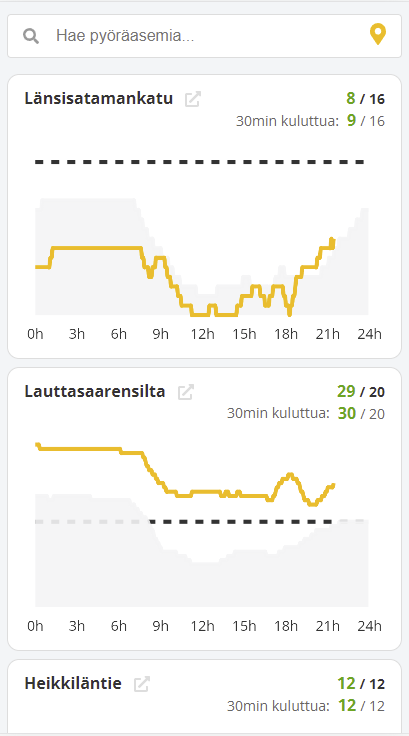
Fillarivahti
30.9.2021 -

Citymapper
8.9.2021 -
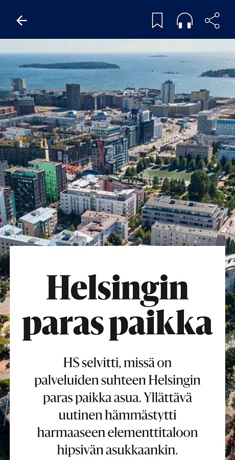
Helsingin paras paikka
2.9.2021 -
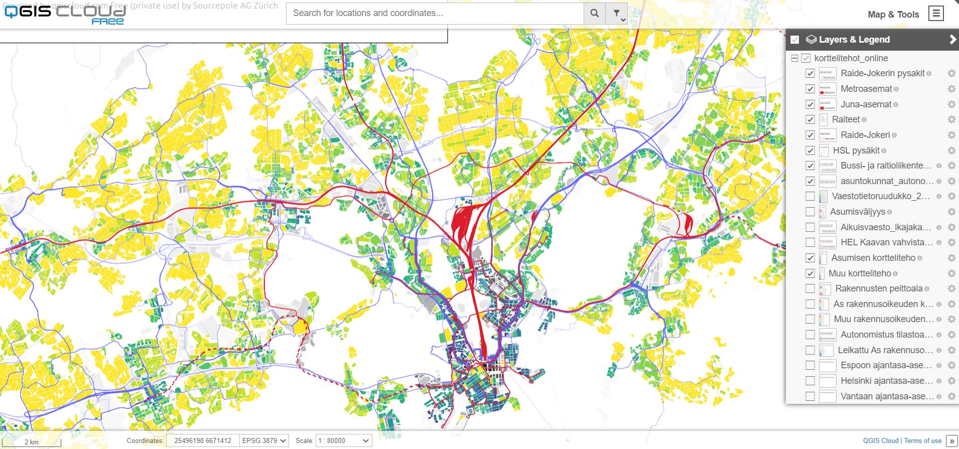
Korttelitehot
18.8.2021 -
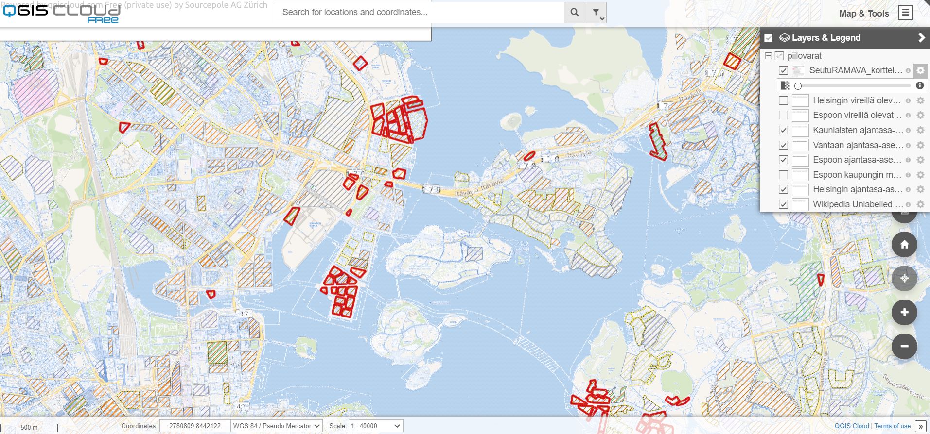
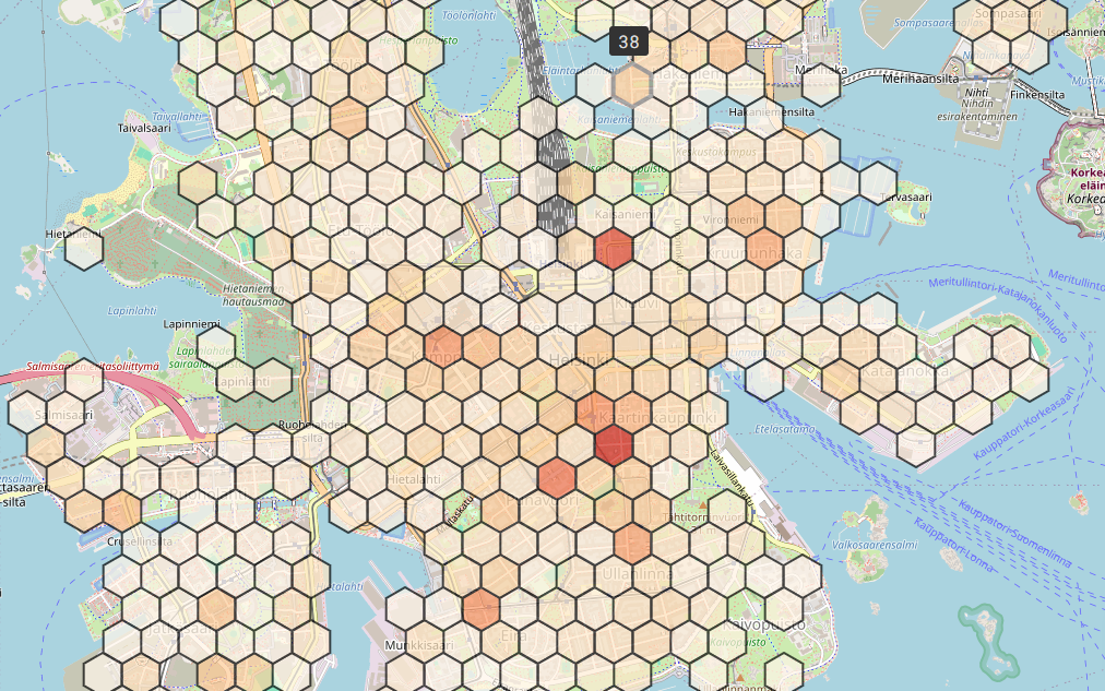
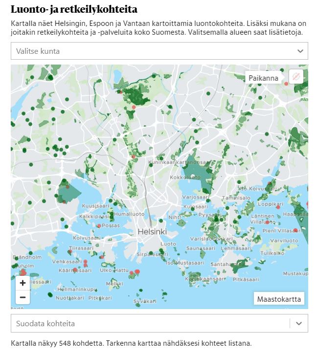
Piilovarat
18.8.2021 -

Uimarannat
18.8.2021 -
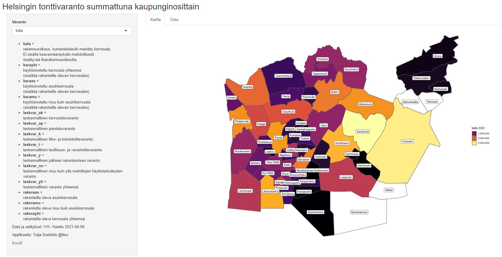
Helsingin tonttivaranto summattuna kaupunginosittain
22.6.2021 -

Läpileikkauksia Helsingin historiaan
21.6.2021 -
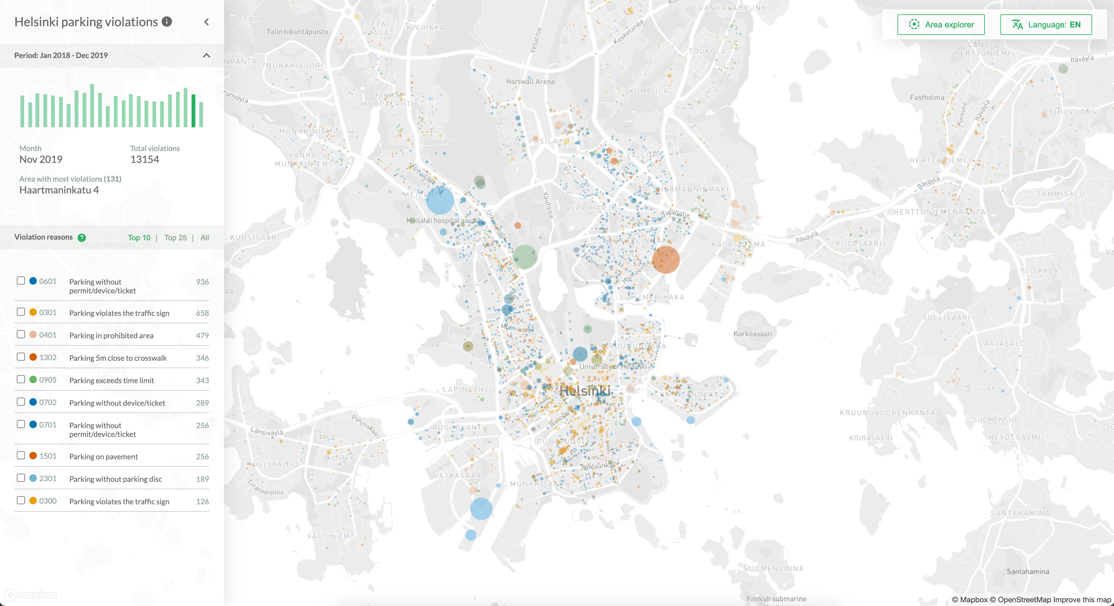
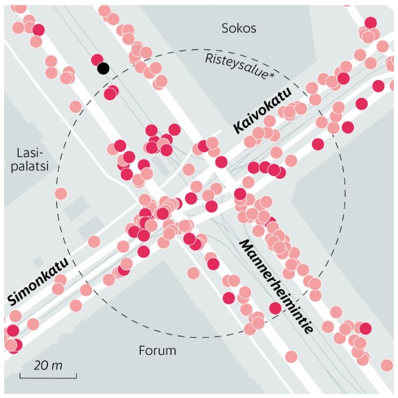
Parking violations and where to find them
17.6.2021