Toggle navigation
Direct link to content
Frontpage
Data
Show submenu for Data
Search data
New data request
Categories
Organizations
Data collections
Showcases
Show submenu for Showcases
All showcases
Submit new showcase
New showcase idea
News
Show submenu for News
Articles
Latest updates
Support
Show submenu for Support
What is open data?
How to open data?
How to use data?
What is HRI?
Show submenu for What is HRI?
What is HRI?
Materials and logos
Contact information
FI
EN
SV
Helsinki
•
Espoo
Vantaa
•
Kauniainen
Helsinki
•
Espoo
•
Vantaa
•
Kauniainen
Open data service
Making better use of public data in the Helsinki region
Datasets
Datasets
Showcases
Other content
Search
593
Datasets
333
Applications
199
APIs
Housing
68
Local government
44
Maps
190
Culture and recreation
64
Traffic and tourism
96
Education
43
Constructed environment
142
Economy and taxation
37
Health and social services
32
Jobs and industries
38
Population
143
Environment and nature
106
All datasets
News
What do you hope to see from open data in the future?
23.03.2026
Management model brings clarity to the opening and maintenance of data
11.10.2023
HRI participated in the EU Open Data Days 2021
29.06.2022
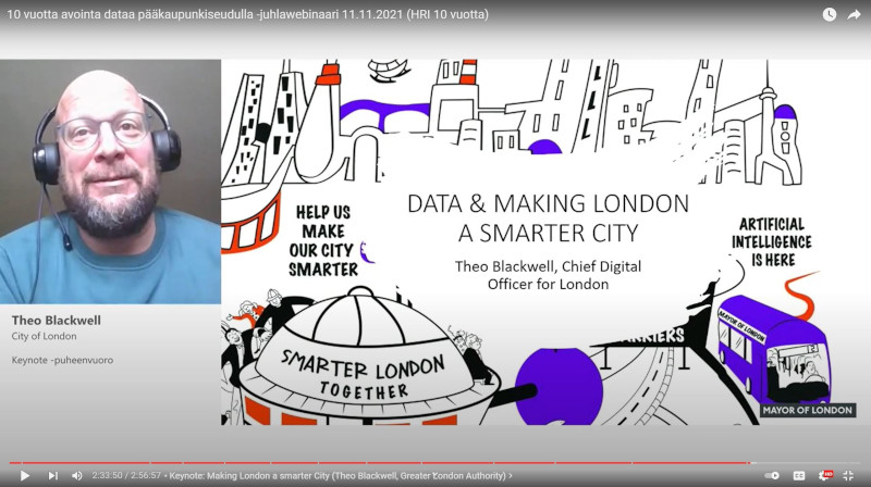
HRI 10 Years Anniversary Webinar: London aims to be the number one of smart cities
15.02.2022
Previous
Next
What do you hope to see from open data in the future?
23.03.2026
Management model brings clarity to the opening and maintenance of data
11.10.2023
HRI participated in the EU Open Data Days 2021
29.06.2022
HRI 10 Years Anniversary Webinar: London aims to be the number one of smart cities
15.02.2022
Show all
Latest showcases
Aateline
02.11.2026
DAVLA Work OS
19.10.2026
Helsinki Lens
13.10.2026
Suomiatlas
09.09.2026
Previous
Next
Aateline
02.11.2026
DAVLA Work OS
19.10.2026
Helsinki Lens
13.10.2026
Suomiatlas
09.09.2026
Do you have a showcase or a showcase idea? Why not publish it in our service?
Submit a showcase
Share a showcase idea
Recently updated data
Dataset
Land usage permission system for public areas in the City of Helsinki
02.11.2026
The City of Helsinki Urban Environment Division manages the city’s public areas and gives the necessary landowner’s consent for the land use of public areas (e.g. construction, events, rentals, terraces, etc.). The related permit granting process is managed by the Land Use and Monitoring unit of Res...
Dataset
Water posts in the Helsinki metropolitan area
02.11.2026
The dataset provides the locations of public water posts in the Helsinki metropolitan area. City residents can freely fetch water from the water posts (e.g. fill their water bottles). The attribute data includes the address, coordinates and identifier of the water post. Data updated in October 2026....
Dataset
Reclaimed land in Helsinki
27.10.2026
The dataset contains Helsinki’s reclaimed areas in a geospatial format. The location of Helsinki’s natural shoreline has been mapped on the basis of historical cartographic sources (1958 natural state map, 1936 Harvia report on municipal amalgamation, 1932 orthophoto, 1907 (approx.) Russian topograp...
Dataset
Traffic Accidents in Helsinki
23.10.2026
The locations, severity levels and types of accidents that have occurred in Helsinki since 2000. The City of Helsinki Urban Environment Division/Traffic and Street Planning maintains a traffic accident register primarily for traffic planning purposes. The accident register is based on information fr...
Previous
Next
Dataset
Land usage permission system for public areas in the City of Helsinki
02.11.2026
The City of Helsinki Urban Environment Division manages the city’s public areas and gives the necessary landowner’s consent for the land use of public areas (e.g. construction, events, rentals, terraces, etc.). The related permit granting process is managed by the Land Use and Monitoring unit of Res...
Dataset
Water posts in the Helsinki metropolitan area
02.11.2026
The dataset provides the locations of public water posts in the Helsinki metropolitan area. City residents can freely fetch water from the water posts (e.g. fill their water bottles). The attribute data includes the address, coordinates and identifier of the water post. Data updated in October 2026....
Dataset
Reclaimed land in Helsinki
27.10.2026
The dataset contains Helsinki’s reclaimed areas in a geospatial format. The location of Helsinki’s natural shoreline has been mapped on the basis of historical cartographic sources (1958 natural state map, 1936 Harvia report on municipal amalgamation, 1932 orthophoto, 1907 (approx.) Russian topograp...
Dataset
Traffic Accidents in Helsinki
23.10.2026
The locations, severity levels and types of accidents that have occurred in Helsinki since 2000. The City of Helsinki Urban Environment Division/Traffic and Street Planning maintains a traffic accident register primarily for traffic planning purposes. The accident register is based on information fr...
Do you have data or data request? Tell it us!
Submit a dataset
Submit data request
Latest updates
Dataset
Land usage permission system for public areas in the City of Helsinki
02.11.2026
The City of Helsinki Urban Environment Division manages the city’s public areas and gives the necessary landowner’s consent for the land use of public areas (e.g. construction, events, rentals, terraces, etc.). The related permit granting process is managed by the Land Use and Monitoring unit of Res...
Dataset
Water posts in the Helsinki metropolitan area
02.11.2026
The dataset provides the locations of public water posts in the Helsinki metropolitan area. City residents can freely fetch water from the water posts (e.g. fill their water bottles). The attribute data includes the address, coordinates and identifier of the water post. Data updated in October 2026....
Dataset
Reclaimed land in Helsinki
27.10.2026
The dataset contains Helsinki’s reclaimed areas in a geospatial format. The location of Helsinki’s natural shoreline has been mapped on the basis of historical cartographic sources (1958 natural state map, 1936 Harvia report on municipal amalgamation, 1932 orthophoto, 1907 (approx.) Russian topograp...
Dataset
Traffic Accidents in Helsinki
23.10.2026
The locations, severity levels and types of accidents that have occurred in Helsinki since 2000. The City of Helsinki Urban Environment Division/Traffic and Street Planning maintains a traffic accident register primarily for traffic planning purposes. The accident register is based on information fr...
Dataset
Orthophotographs of Helsinki
22.10.2026
This dataset provides the orthophotographs of Helsinki in GIS API from 1932 to present day. Additionally, photos from 1988, 1976, 1969, 1964, 1950, 1943 and 1932 are provided as image files. The Helsinki area is photographed from the air at regular intervals. Exact dates for each year's photographs...
Dataset
Helsinki morbidity index
19.10.2026
The morbidity index is calculated by means of three register variables describing the morbidity of the population. These are the share of people on disability pension among the working-age population, the share of persons entitled to special reimbursements for medicines (representing long-term morbi...
Dataset
Number of students in basic and upper secondary education in Kauniainen
19.10.2026
The dataset includes the number of pupils and students in Kauniainen basic education and general upper secondary education by school and grade on 20 September according to the situation from 2012 onwards. Kauniainen has two Finnish-language and two Swedish-language schools that are covered by basic...
Dataset
Visitors by location and by month in the City of Espoo library
14.10.2026
Data on the amount of visitors in every City of Espoo library since 2009.
Previous
Next
Dataset
Land usage permission system for public areas in the City of Helsinki
02.11.2026
The City of Helsinki Urban Environment Division manages the city’s public areas and gives the necessary landowner’s consent for the land use of public areas (e.g. construction, events, rentals, terraces, etc.). The related permit granting process is managed by the Land Use and Monitoring unit of Res...
Dataset
Water posts in the Helsinki metropolitan area
02.11.2026
The dataset provides the locations of public water posts in the Helsinki metropolitan area. City residents can freely fetch water from the water posts (e.g. fill their water bottles). The attribute data includes the address, coordinates and identifier of the water post. Data updated in October 2026....
Dataset
Reclaimed land in Helsinki
27.10.2026
The dataset contains Helsinki’s reclaimed areas in a geospatial format. The location of Helsinki’s natural shoreline has been mapped on the basis of historical cartographic sources (1958 natural state map, 1936 Harvia report on municipal amalgamation, 1932 orthophoto, 1907 (approx.) Russian topograp...
Dataset
Traffic Accidents in Helsinki
23.10.2026
The locations, severity levels and types of accidents that have occurred in Helsinki since 2000. The City of Helsinki Urban Environment Division/Traffic and Street Planning maintains a traffic accident register primarily for traffic planning purposes. The accident register is based on information fr...
Dataset
Orthophotographs of Helsinki
22.10.2026
This dataset provides the orthophotographs of Helsinki in GIS API from 1932 to present day. Additionally, photos from 1988, 1976, 1969, 1964, 1950, 1943 and 1932 are provided as image files. The Helsinki area is photographed from the air at regular intervals. Exact dates for each year's photographs...
Dataset
Helsinki morbidity index
19.10.2026
The morbidity index is calculated by means of three register variables describing the morbidity of the population. These are the share of people on disability pension among the working-age population, the share of persons entitled to special reimbursements for medicines (representing long-term morbi...
Dataset
Number of students in basic and upper secondary education in Kauniainen
19.10.2026
The dataset includes the number of pupils and students in Kauniainen basic education and general upper secondary education by school and grade on 20 September according to the situation from 2012 onwards. Kauniainen has two Finnish-language and two Swedish-language schools that are covered by basic...
Dataset
Visitors by location and by month in the City of Espoo library
14.10.2026
Data on the amount of visitors in every City of Espoo library since 2009.
More updates