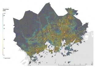
The map shows the travel time to hypermarkets using Helsinki Region Transport as a method of transportation. The colour of the roads changes according to how many minutes it takes to travel from a specific point on the map to the nearest hypermarket. The visualization has been done with the ArcGIS application. The travel times have been calculated using a tool co-created by the Metropaccess project and Busfaster Ltd. Their tool makes it easy to quickly calculate the travel times of public transport while utilising the journey planner API.
The app is no longer available.