Direct link to content
  • Frontpage
  • Data
    • Search data
    • New data request
    • Categories
    • Organizations
    • Data collections
  • Showcases
    • All showcases
    • Submit new showcase
    • New showcase idea
  • News
    • Articles
    • Latest updates
  • Support
    • What is open data?
    • How to open data?
    • How to use data?
  • What is HRI?
    • What is HRI?
    • Materials and logos
    • Analytics
    • Contact information
  • FI
  • EN
  • SV
Helsinki • Espoo Site logo Vantaa • Kauniainen
Helsinki • Espoo • Vantaa • Kauniainen
  1. Frontpage
  2. Showcases
  3. Helsingin tonttivaranto...

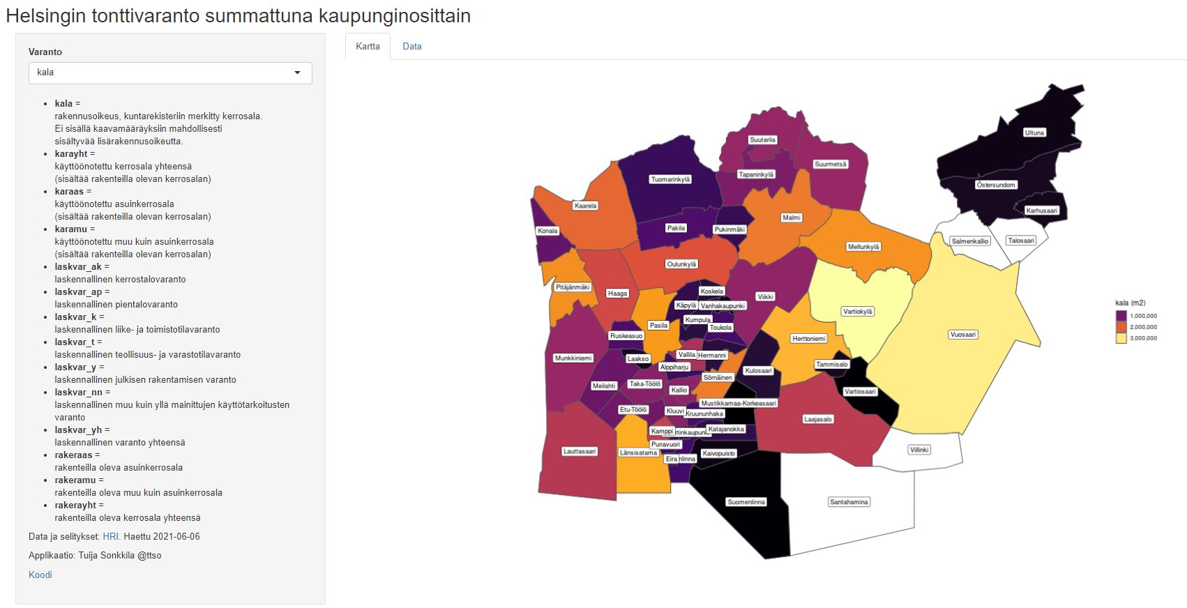
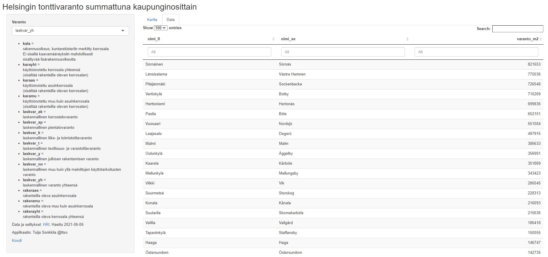
Helsingin tonttivaranto summattuna kaupunginosittain

Visualisations
  • plot reserve
  • construction
Tuija Sonkkila - Published 22.6.2021 - Updated 22.6.2021
  1. 2021-06-22-060931.510800tonttivarantosummattunakokosovellus.JPG
  2. 2021-06-22-060931.583014tonttivarantosummattunadata.JPG

Plot reserve of Helsinki visualized.

Code: https://github.com/tts/rak

Used datasets

  • Lot reserve in the Helsinki Metropolitan Area per block (SeutuRAMAVA)

    The dataset contains information on valid city plans in the Helsinki metropolitan area (Espoo, Helsinki, Kauniainen, Vantaa) in floor square metres, summed up at the block level...
    • WFS
    • WMS
    • SHP
    • TAB
    • KML
    • XLSX

By the same author

  • Geographic orientation of the streets of Helsinki

  • Walk and bike in Helsinki

  • Helsingin yleisimmät kadunnimet

  • Helsinki trees and areas

  • Helsingin katujen pituudet kartalla

Show all
Showcase website arrow_forward Author website arrow_forward

By the same author

  • Geographic orientation of the streets of Helsinki

  • Walk and bike in Helsinki

  • Helsingin yleisimmät kadunnimet

  • Helsinki trees and areas

  • Helsingin katujen pituudet kartalla

Show all
  • Data portal arrow_forward
  • Content management arrow_forward
Site logo
Follow us

  • Terms and conditions
  • Data Protection
  • Contact information
  • Accessibility (in Finnish)