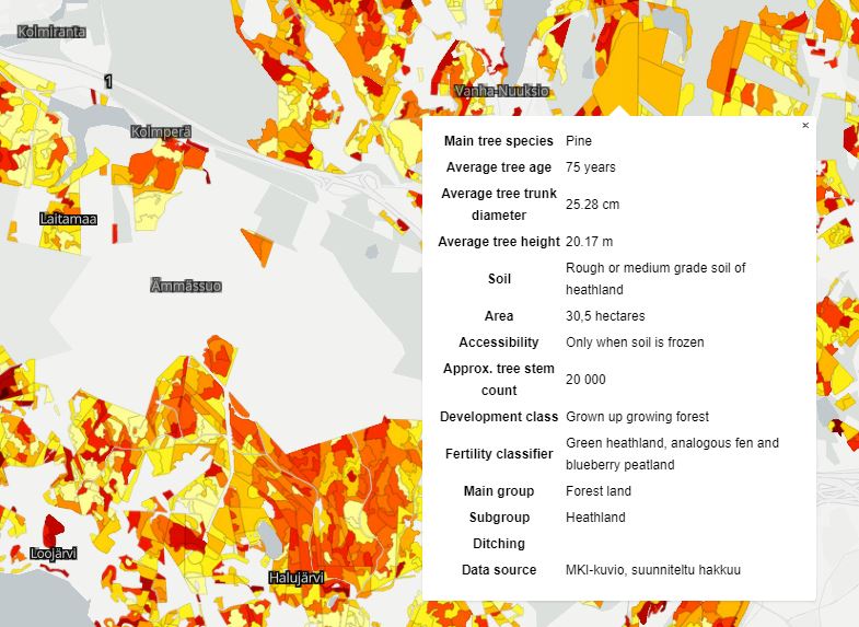
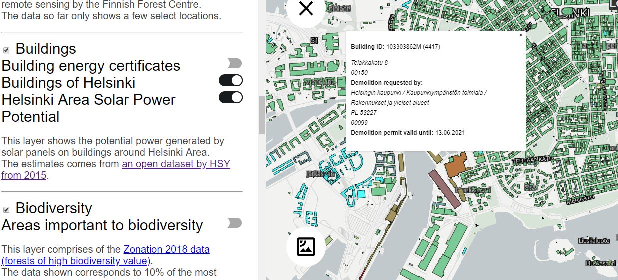
Direct link to content
  • Frontpage
  • Data
    • Search data
    • New data request
    • Categories
    • Organizations
    • Data collections
  • Showcases
    • All showcases
    • Submit new showcase
    • New showcase idea
  • News
    • Articles
    • Latest updates
  • Support
    • What is open data?
    • How to open data?
    • How to use data?
  • What is HRI?
    • What is HRI?
    • Materials and logos
    • Analytics
    • Contact information
  • FI
  • EN
  • SV
Helsinki • Espoo Site logo Vantaa • Kauniainen
Helsinki • Espoo • Vantaa • Kauniainen
  1. Frontpage
  2. Showcases
  3. Sustainability Map

Sustainability Map

Applications
Avoin ry - Published 16.8.2019 - Updated 16.8.2019
  1. 2019-08-16-095931.525770avoinmap.JPG
  2. 2019-08-16-095931.697539avoinmap2.JPG
  3. 2019-08-16-095931.821603avoinmap1.JPG

The map displays areas where actions are required in order to save environmental resources.

Used datasets

  • Buildings in Helsinki

    The Buildings in Helsinki data contains information on buildings from two different sources. Map features (layer Rakennukset_alue) are based on the building areas of the base...
    • PNG
    • WMS
    • WFS
    • TAB
  • Photovoltaic potential in the Helsinki metropolitan area

    The data contains the photovoltaic production potential calculated per building, provided that the entire area suitable for solar panels is covered with solar panels. When...
    • WFS
    • WMS
    • SHP
Showcase website arrow_forward
  • Data portal arrow_forward
  • Content management arrow_forward
Site logo
Follow us

  • Terms and conditions
  • Data Protection
  • Contact information
  • Accessibility (in Finnish)