Antimaps.com (Archived)

Visualizations
Antti Vähätalo - Published 13.12.2017 - updated 13.12.2017
  1. 2017-12-13-081630.420820antimaps-310x195.jpg

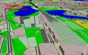
Terrain maps are often difficult to understand because they contain many map symbols that need to be remembered. Antimaps is easy to read because it uses 3D map with descriptive 3D symbols. Any point in the map can be clicked to get info about areas and objects. It is also easy to add new information to the map without making it messy.

Antimaps uses three.js JavaScript library. All other software and graphics have been developed in this work.

Update 12/2017: This visualization is no longer available.

Used datasets

comments powered by Disqus