-

Perfekt City
14.12.2017 -
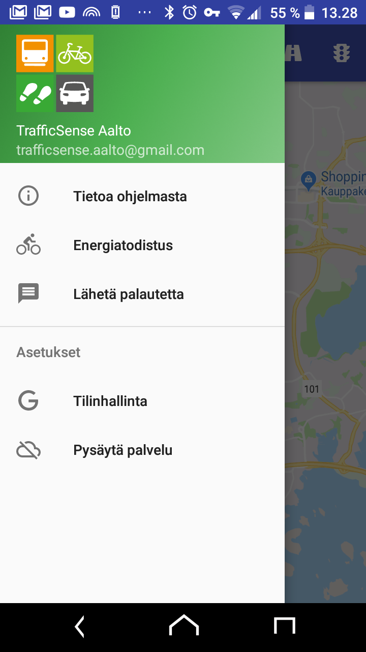
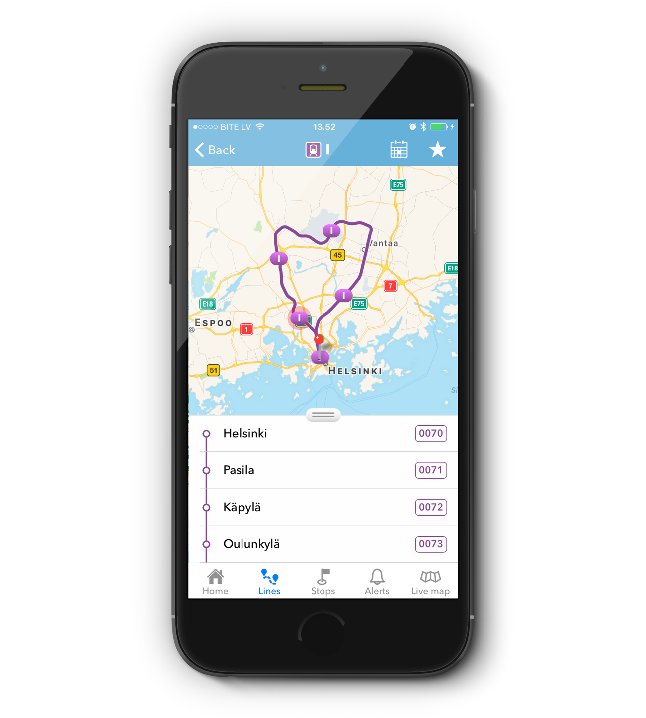
TrafficSense
14.12.2017 -

Mapple
14.12.2017 -

Perille
14.12.2017 -
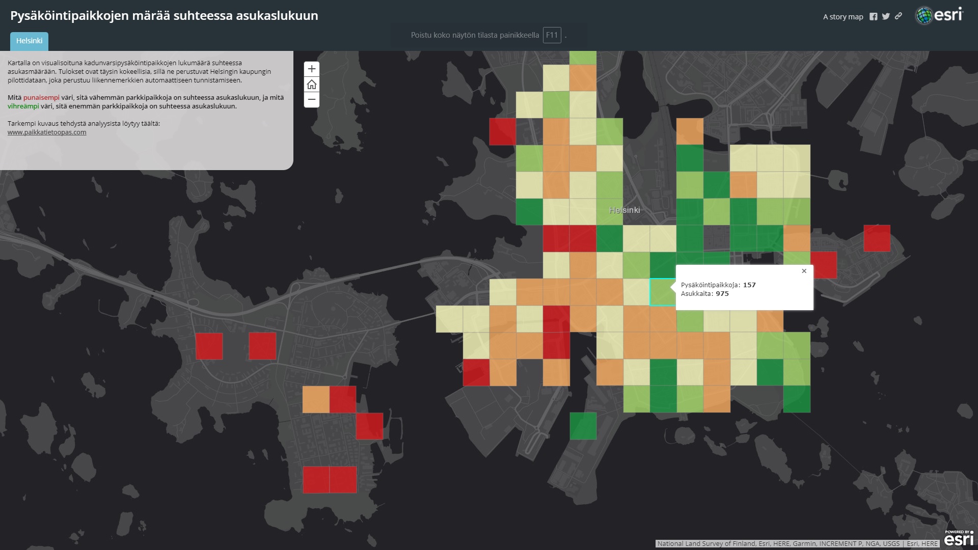
Pysäköintipaikkojen määrä suhteessa asukaslukuun
14.12.2017 -
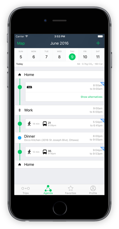
moovel
13.12.2017 -
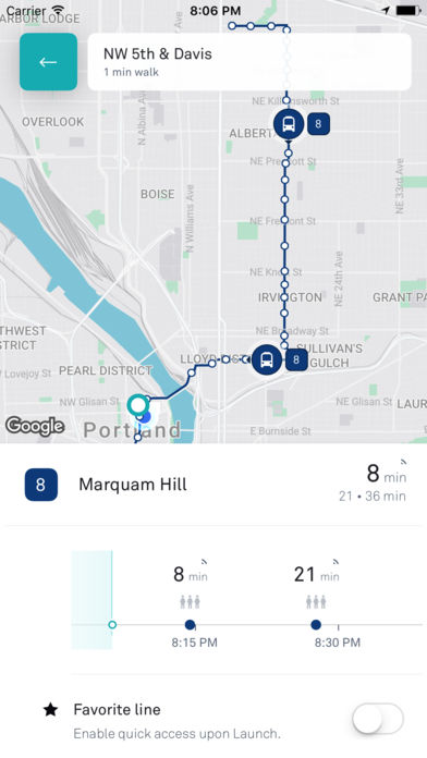
Lähimmät lähdöt
13.12.2017 -
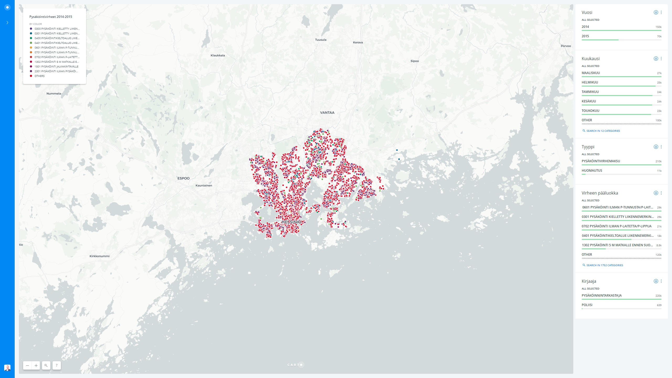
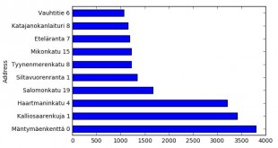
Missä Helsingissä pysäköidään väärin?
13.12.2017 -
Aineiston käsittely datapakettina
13.12.2017 -
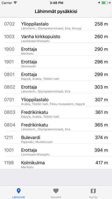
TaHslOnlineInfo
13.12.2017 -
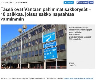
Tässä ovat Vantaan pahimmat sakkorysät
13.12.2017 -
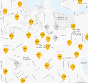
Kaupunkifillarit
13.12.2017 -
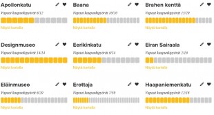
Cityfillarit
13.12.2017 -
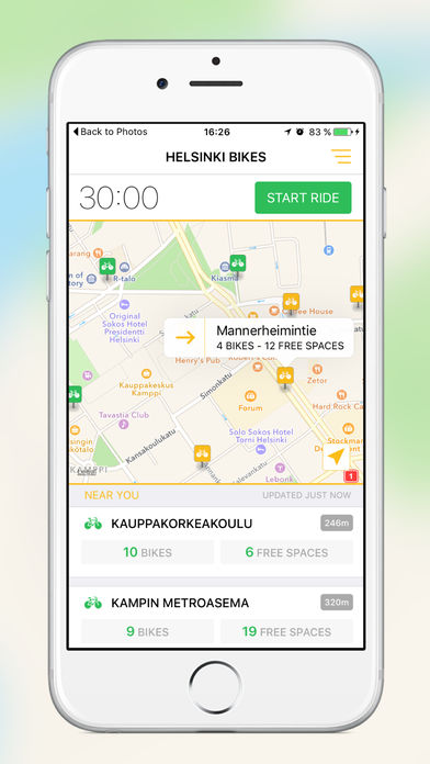
Helsinki Bikes
13.12.2017 -
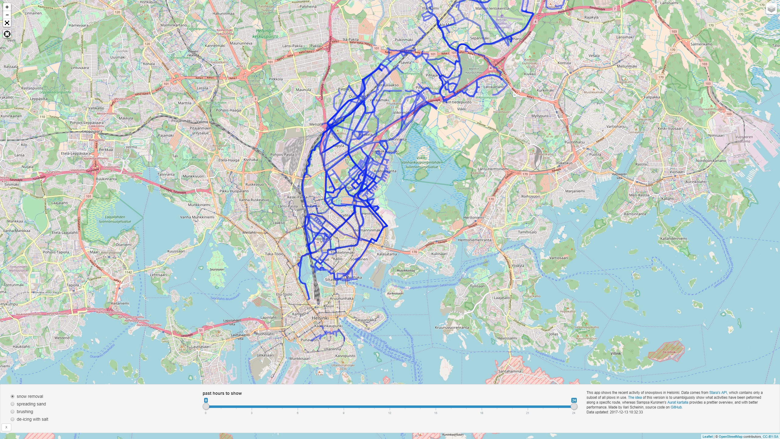
Snowplows of Helsinki
13.12.2017 -
Transporter
13.12.2017 -
TripGo
13.12.2017 -
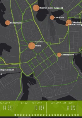
Visualisointi Helsingin pyöräilijämääristä
12.12.2017