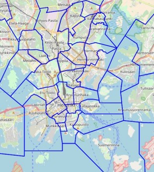
Direct link to content
  • Frontpage
  • Data
    • Search data
    • New data request
    • Categories
    • Organizations
    • Data collections
  • Showcases
    • All showcases
    • Submit new showcase
    • New showcase idea
  • News
    • Articles
    • Latest updates
  • Support
    • What is open data?
    • How to open data?
    • How to use data?
  • What is HRI?
    • What is HRI?
    • Materials and logos
    • Analytics
    • Contact information
  • FI
  • EN
  • SV
Helsinki • Espoo Site logo Vantaa • Kauniainen
Helsinki • Espoo • Vantaa • Kauniainen
  1. Frontpage
  2. Showcases
  3. Helsinki Districts

Helsinki Districts

Visualizations
  • districts
Fredrik Boström - Published 14.12.2017 - Updated 28.6.2022
  1. 2017-12-14-105801.962450Hginkaupunginosat-310x346.jpg

Map of districts in Helsinki.

The app is no longer available.

Used datasets

  • District Map of the City of Helsinki

    The Helsinki districts dataset includes the boundary lines of the city districts, as well as the names and identifiers of the areas. The initial data for the maintenance of the...
    • WMS
    • WFS
Author website arrow_forward
  • Data portal arrow_forward
  • Content management arrow_forward
Site logo
Follow us

  • Terms and conditions
  • Data Protection
  • Contact information
  • Accessibility (in Finnish)