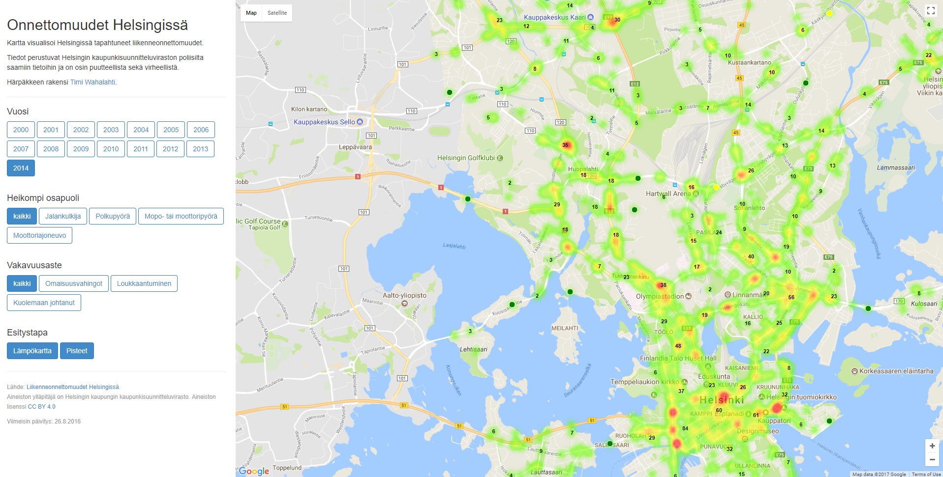
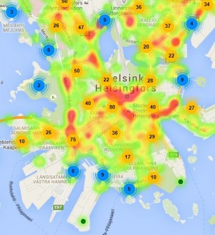
Onnettomuudet Helsingissä

Timi Wahalahti - Published 12.12.2017 - Updated 8.11.2023
  1. 2017-12-12-130943.895501onnettomuudethelsingissa-iso.jpg

The map visualizes traffic accidents that happened in Helsinki. It is possible to filter accidents by year, by the weaker party, as well as by the severity of the accident. As a display method, the user can choose between traditional points on the map and a heat map.

The information is based on information obtained from the police via the City of Helsinki Urban Environment Division. The information may include errors and inaccuracies.

The app is no longer available.

Used datasets

comments powered by Disqus