Skip to content
  • FI
  • EN
  • SV
Helsinki • Espoo Site logo Vantaa • Kauniainen
Helsinki • Espoo • Vantaa • Kauniainen
  1. Home
  2. Showcases
  3. Geographic orientation of...

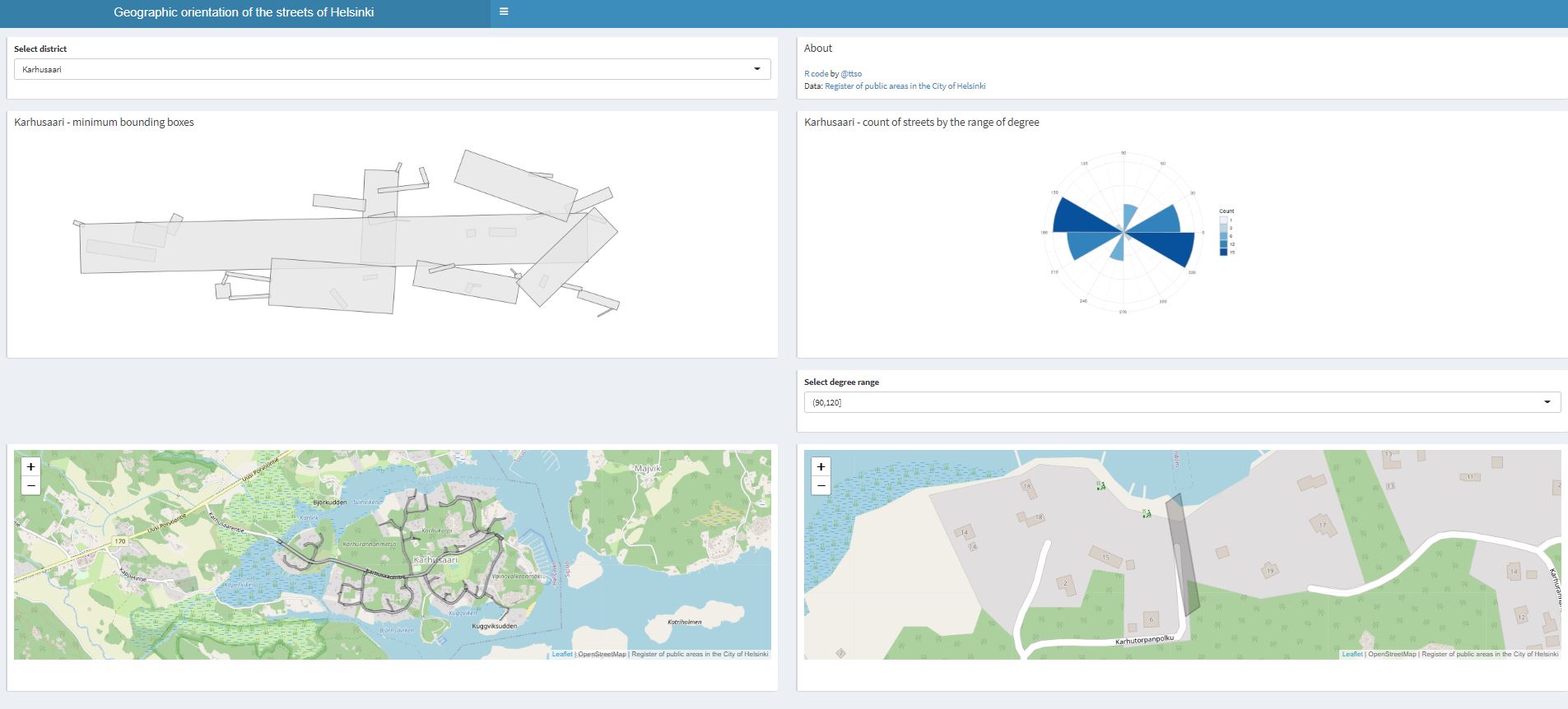
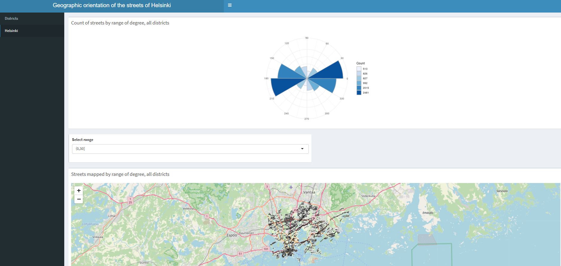
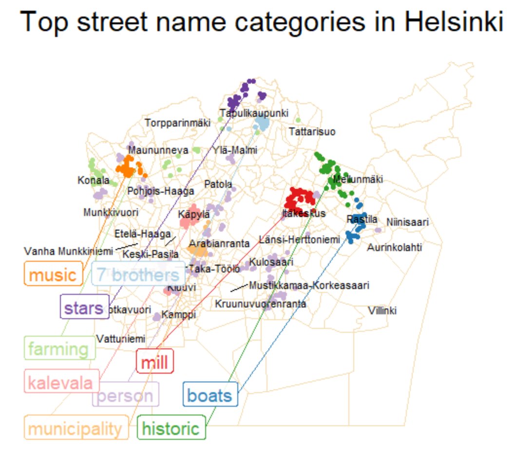
Geographic orientation of the streets of Helsinki

Applications
  • streets
  • neighbourhood
Tuija Sonkkila - Published 6.10.2022 - updated 6.10.2022
  1. 2022-10-06-123244.677885geographicorientationofthestreetsHelsinkiKarhusaari.JPG
  2. 2022-10-06-123244.736716geographicorientationofthestreetsHelsinkikansi.JPG

The streets and their orientation in Helsinki by district. The whole city can be inspected by clicking the options button in the upper part of the page and selecting "Helsinki".

Code: https://github.com/tts/hkidistricts

Used datasets

  • Register of public areas in the City of Helsinki

    The register of public areas (YLRE) is a system of the Helsinki Urban Environment Division that contains information about the city’s street and green areas. The dataset is...
    • WMS
    • WFS

More from the author

  • Helsingin tonttivaranto summattuna kaupunginosittain

  • Walk and bike in Helsinki

  • Helsingin yleisimmät kadunnimet

  • Helsinki trees and areas

  • Helsingin katujen pituudet kartalla

Show all from this author
Application website arrow_forward Author website arrow_forward

More from the author

  • Helsingin tonttivaranto summattuna kaupunginosittain

  • Walk and bike in Helsinki

  • Helsingin yleisimmät kadunnimet

  • Helsinki trees and areas

  • Helsingin katujen pituudet kartalla

Show all from this author
  • Data portal arrow_forward
  • Content management arrow_forward
Site logo
Follow us