Date
Categories
Author
-
Petja Partanen
QGIS already suitable for experts
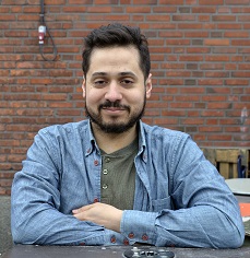
Geographic information expert Faris Alsuhail uses a quickly developing, free and open source geographic information software in his own hobby projects as well as professionally.
One of HRI application gallery’s most active data enthusiasts is geographic information expert Faris Alsuhail. Using open data from Helsinki Metropolitan Area, Alsuhail has developed several apps; including an app for Northern Lights and apps for finding the nearest pubs or ATMs in Helsinki. His favorite tool for handling geographic data is the free and open source geographic information software QGIS. “It is versatile and free. The QGIS community also offers a vast variety of community developed add-ons”, Alsuhail praises.
Faris Alsuhail became familiar with QGIS during his studies about ten years ago. During the academic curriculum, professional softwares such as ArcGIS and MapInfo were used but were only available in the University’s computer labs. Back then, free open source software alternatives that were intended for home use were disappointing. “Back then, QGIS 0.7 -version was available. I couldn’t do much with it.”
Another challenge back then was that geographic data was not available as open data. QGIS included sample files from Alaska, and they didn’t really warm the mind of a student in Finland. “Back then, you had to pay to use Finnish topographic databases”, Alsuhail explains.
The next encounter with QGIS happened in 2012, while Alsuhail worked at the University of Turku and was asked to teach a GIS course for Finnish local and regional authorities. QGIS was used as the tool, so being the teacher, Alsuhail had to master the software. During the last three years working for City of Helsinki’s Urban Facts department, Alsuhail mastered the use of QGIS in detail. “City of Helsinki Urban Facts did own licenses for commercial MapInfo software, but I felt that QGIS better suited the needs of urban research.”
QGIS supports all relevant file formats. Also, the user centered design of the software pleases more than the costly alternative, MapInfo. “The community around QGIS has grown rapidly in Finland, as well as internationally. QGIS has developed immensely.”
Who?
Faris Alsuhail b. 1984
Education: MSc, Environmental Science, University of Turku
Employer: Karttakeskus, geographic information specialist
Favorite open data tools
1. QGIS Open Source -geographic information software “Versatile – and free.”
2. Excel “It has a big role when handling data.”
3. Notepad ++ “It is easy to make changes for the visualization’s HTML code.”
Completed open data projects
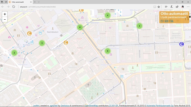
Otto-ATMs on map
Helsinki’s pubs
Where to start a coffeehouse?
Most interesting open dataHelsinki’s city bicycles data. “Generally interested in all big datasets, which include geospatial data.”
Mac or PC PC
Faris Alsuhail on LinkedIn
Recently, Alsuhail joined Karttakeskus but it didn’t hinder him from continuing geospatial analyses in his free time. His latest project with QGIS was done for the databusiness.fi website, for which he analyzed the most viable locations for starting a coffeehouse. Alsuhail clicks and makes visible all current coffeehouses from the City of Helsinki’s Urban Environment Division’s open data. When location data is combined with a variety of different open data resources, such as City of Helsinki’s road map and the Kiva keskusta kävelijöille -survey (tr. Nice centre for pedestrians), it results in an analysis of the Ruoholahti area to be the most viable location for new coffeehouses. The area is deemed to be pleasant, traffic connections are good but current supply of coffeehouses is weak.
Since Alsuhail’s studies, geographic information has become ordinary. The normal citizen isn’t aware of the presence of geographic information when using Google Maps and public transport journey planners or when playing Pokémon GO. Also, tools used by GIS professionals and hobbyists are now better than ever before. “During my studies, we dreamt of free geographic information applications. Now, there is a lot of open data available and there are free applications for collecting data, analysing data and publishing data on interactive maps”, Alsuhail explains.
Geographic information has become a part of everyday life
When data and tools are available, the barrier for anyone who is interested in creating light weight geographic information apps is very low. When Faris Alsuhail got fed up of searching for ATMs that were slowly disappearing from the streets, he quickly made an map based app to help himself. Now, a similar service is also found on the otto.fi website of Automatia, the provider of ATMs.
Also, the barrier to learning new tools has lowered. “Before, the first stumbling block were different coordinate systems: Helsinki had it’s own, as did Google maps.”
Now, the metadata of open data resources tells the user, which coordinate system the data uses, and QGIS is able to handle coordinate changes automatically. Also, programming skills are no longer a necessity. Alsuhail points out that he has got by without needing in-depth programming skills. “However, there are a lot of things that could be done more efficiently with self developed programs, especially if the data has millions of rows.”
Translated by: Kaarlo Uutela
Old discussion 2017/08/31 at 1:56 / Salman Alsuhail
Is it ok to translate to Arabic?
Old discussion 2017/09/01 at 15:09 / Hami Kekkonen
Yes, it’s ok but please mention author’s name (Petja Partanen) and the original soucre (www.hri.fi) in your translation.