Date
Categories
Author
-
Petja Partanen
Open geographic information is valuable
With geographic information expert Antti Ahola’s favourite tool ArcGIS numerical data turns into maps both at work and play.

The data openers yearn for feedback about where the data they publish is being utilised. A rule of thumbs seems to be that the more valuable the data is to its utiliser, the less is said about its utilisation. Geographic information expert Antti Ahola is also tight-lipped about his customer projects. “Quite often, work meetings start with the signing of a non-disclosure agreement”, reveals Antti Ahola.
The most important clients of Ahola’s Geosprint Oy are private companies. For example, building and real estate, banks and retail trade utilise open geographic information reserves effectively. Among other things, the data reserves included in HRI’s data catalogue are being used actively. “The data is extremely useful”, he confirms.
However, Ahola is happy talk about his personal geographic information projects. One of them broke the news barrier in July 2017, when Helsingin Sanomat wrote an article on how Antti Ahola three-dimensionalised old aerial photographs. Ahola’s visualisation shows from a bird’s perspective what Helsinki looked like in 1943 and how the city has developed to the modern day.
“It was great to be able to see the Helsinki of 1943 for the first time, study it and fly around the city. I immediately thought that I will definitely share this with everyone.”
Even the tools are the same as in the enterprise projects. The Historical Helsinki visualisation could easily be mistaken for a project of several months, but Ahola says that it was created with his favourite tool, the ArcGIS software, in one evening. All the necessary data, the 1943 aerial photograph and the city’s 3D model, were directly available in HRI’s data catalogue.
Starting with freeware
Virtual Helsinki in 1943 was created by taking the 3D city model of Helsinki and then filtering out all buildings that were constructed after the year 1943. Ahola placed the remaining old building stock with its facade textures on the aerial photograph from 1943 and changed the colours of the buildings to black and white. Thanks to the new 3D features of the ArcGIS Online tool, the user can fly around the city and compare photographs side by side to see how the city has changed in 70 years. “The application was created just by clicking in ArcGIS, without a single line of code.”

Ahola’s favourite software, ArcGIS, which was launched in 1999, is the market leader in GIS software. “The web-based free online version goes a long way for fiddling around with open data. If you are looking to make money, you will obviously have to get the licence”, says Ahola.
One of the best features of the programme is that it can read data directly from the WMS and WFS geographic information interfaces of the cities. “For example, Helsinki’s latest aerial photographs can be retrieved directly from the city’s WMS interface. Then I could, for instance, have the addresses of the Helsinki daycare centres in an Excel file. Just drag them on the map and the visualisation is ready”, explains Ahola.
Who?
Antti Ahola b. 1983
Education: M.Sc., Aalto university, Geoinformatics
Job: Geosprint Oy, founder, geographic information expert
Favourite open data tools
1. ArcGIS geographic information software
2. Python “I use less and less Excel for the background analyses.”
3. Pen and paper “After an iPad period, I am once again using pen and paper in the planning.”
Works completed with open data
Dozens of ArcGIS geographic information analyses in the Paikkatieto-opas blog.
What data would be interesting
”The tax-funded Grid Database by the Central Statistical Office of Finland, which includes information on Finland’s population’s structure, education, housing, income and employment in 250 m x 250 m grids, would be nice to have as open data. Currently, it is subject to a fee, the price for consultant use is maybe 10,000 euros.”
Mac, Windows or Linux
Windows and Linux
Note to the HRI service
”Thank you very much! You are doing a super job. Open data is excellent fuel for a map creator.”
The interactive maps made in ArcGIS can be shared easily, posted on Facebook or integrated on its own website. “ArcGIS.com includes a lot of open data to begin with. For example, if you need world maps, such can be found in the service.”
Own blog full of work samples
From Ahola’s Paikkatieto-opas blog it is easy to determine that there are daycare-aged children in Ahola’s family. The “Are there enough daycare centres” and “Children without playgrounds” maps show graphically how the number of children and the supply of services in the metropolitan area meet.
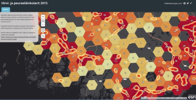
AAhola’s geographic information blog includes dozens of posts, which show on a map how business subsidies are distributed to different areas, where in Finland there is gold or if there are enough parking spaces in Helsinki. Each blog post comes with an explanation on what open data sources the visualisation uses and how the analysis has been created.
Ahola’s blog encourages to explore the world of geographic information. Open data is available, the tools are easy to use, and coding skills are not necessary. However, programming skills are beneficial, especially in the pre-processing of data. “ArcGIS and Python is a good combination. I use Python for the background analyses, ArcGIS for the map visualisations. For example, the National Land Survey of Finland’s cadastral boundaries have been published as open data, but the data consists of around 40,000 separate files. To combine them, you need Python.”
Making the world a better place
The subheading of Ahola’s blog is Applying geography medicates the well-being. “That is how I see it. And open data is an indispensable component here.”
Ahola believes in decision-making based on facts and he is always happy when his blog is being read. For example, during the traffic safety campaign in September, many parents in Turku went to check out the dangerous spots in their neighbourhoods from the map in the Finland’s most dangerous school trips blog post. The city of Espoo’s early childhood education sub-committee is said to have made analyses resembling the Are there enough daycare centres as a basis for their planning.
Ahola thinks that the municipal sector is still in the early stages in the utilisation of geographic information. “The situation seems to be that this kind of data is not used in the decision-making of the municipalities. It is a shame.”
Using the current tools, a person who is unafraid of information technology can create own analyses as well. And if the own skills are not sufficient, a geographic information expert can always be called upon. “It is not nearly as difficult or expensive as many people would imagine”, advertises Ahola.
Translated by Henrik Andersson
Leave a Reply