-
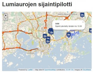
Lumiaurojen sijaintipilotti
8.12.2017 -

Hypermarketien saavutettavuus julkisella liikenteellä pk-seudulla
30.11.2017 -
Reitit v2.0
30.11.2017 -
ShareNav
30.11.2017 -

OpenTravelTime
30.11.2017 -
Ihan hyvä reittiopas
30.11.2017 -
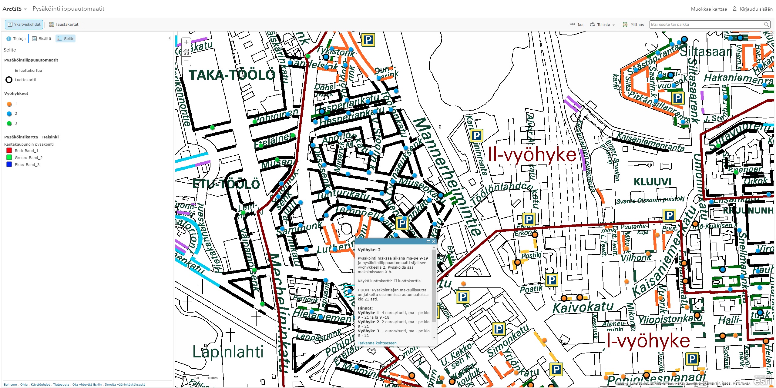
Helsingin pysäköintilippuautomaatit
29.11.2017 -
Liikenneonnettomuuksien tiheys lämpökarttana
29.11.2017 -
ParkMan
29.11.2017 -
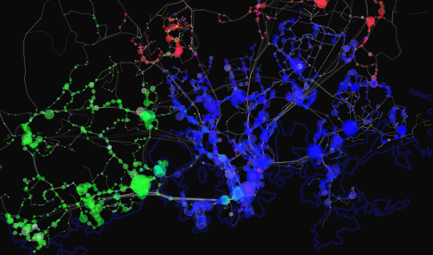
Missä Helsingissä rysähtää?
29.11.2017 -
Kyyti
29.11.2017 -
Ajoissa
29.11.2017 -
Liikennemäärien visualisointi
29.11.2017 -
Helsingin vaarallisimmat risteykset
28.11.2017 -
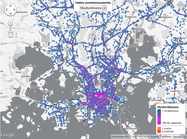
Helsingin liikenneonnettomuudet
28.11.2017 -

Reitit for iPhone
28.11.2017 -
busbus
28.11.2017 -
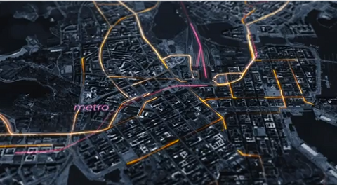
Helsinki Public Transport Visualized
28.11.2017