Skip to content
  • FI
  • EN
  • SV
Helsinki • Espoo Site logo Vantaa • Kauniainen
Helsinki • Espoo • Vantaa • Kauniainen
  1. Home
  2. Showcases
  3. Helsinki ilmakuvina 1932 alkaen

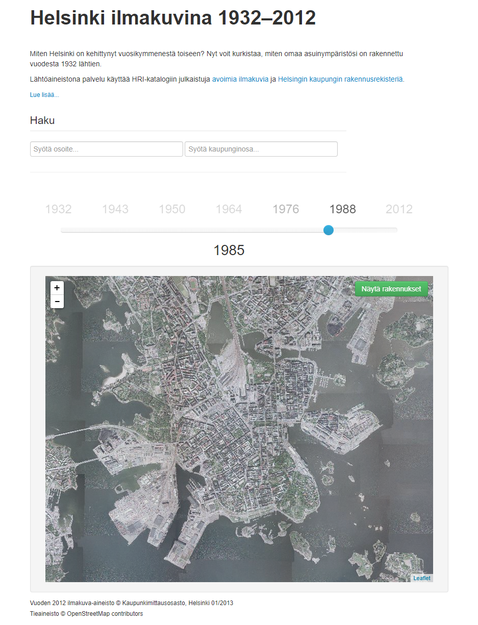
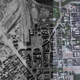
Helsinki ilmakuvina 1932 alkaen (Archived)

Applications, Visualizations
  • history
  • aerial photographs
  • ortophotographs
Helsingin kaupunki - Published 8.12.2017 - updated 27.3.2024
  1. 2017-12-08-140445.825339helsinkiilmakuvina1.png

How has Helsinki developed throughout the last decades? Now you can see how your environment has been built beginning from 1932.

Note: The application does not work anymore.

Used datasets

  • Orthophotographs of Helsinki

    This dataset provides the orthophotographs of Helsinki in GIS API from 1932 to present day. Additionally, photos from 1988, 1976, 1969, 1964, 1950, 1943 and 1932 are provided as...
    • WMS
    • WMTS
    • TIFF
  • District division of the City of Helsinki

    The Helsinki district division data includes the boundary lines of the districts within the city, as well as the names and identifiers of the areas. The district division system...
    • WMS
    • WFS
    • TAB
    • GPKG
  • Database of addresses of Helsinki

    The database of addresses of Helsinki maintains information about the addresses and place names of properties and plan units located in the area of Helsinki. The street names...
    • WMS
    • WFS

More from the author

  • Kokeilukiihdyttämö

  • DataLokki - Helsinki Destination Insights

  • Datasette

  • Minecraft-Helsinki3D+

  • Sateenvarjo ilmakuvasta

Show all from this author

More from the author

  • Kokeilukiihdyttämö

  • DataLokki - Helsinki Destination Insights

  • Datasette

  • Minecraft-Helsinki3D+

  • Sateenvarjo ilmakuvasta

Show all from this author
  • Data portal arrow_forward
  • Content management arrow_forward
Site logo
Follow us