Text Petja Partanen
In 2011, aerial photos for the whole of Finland would have cost hundreds of thousands of euro. Now they cost nothing at all.
The National Land Survey was the first government agency to unlock its digital geodata sets for the citizens and enterprises to use cost-free. Lots of enthuastic users have discovered the aerial photos, elevation models and vector and raster maps that were made publicly available in May 2012. In the first nine months, more than a million map files were downloaded through the online service.
For many years, the personnel of the National Land Survey watched helplessly as the cost-free but inaccurate Google maps were used in various online map services instead of the National Land Survey’s top class digital map resources, which had been produced with the taxpayers’ money
”High quality material was replaced in use by lower quality material”, says Antti Rainio.
The long-term work of Antti Rainio and other open data advocates begun to bear fruit in December 2011 when the fee regulations of the National Land Survey were changed so that the geodata were no longer subject to licence fees.
The alteration initiated a project, unprecedented within the National Land Survey.
”The steering boards of our projects meet usually once every month. But during this project, it was discussed how many times a week should we meet to guide the work of the project”, Antti Kosonen recalls the spring of 2012.
In four months the experts had to go through all of the 18 digital datasets covering the entire country, altogether more than 100 products.
”We had to alter the products, design a new licence that would allow the material to be handed over to users, build a new download service... Our 100-megabyte Internet connection was updated to a gigabyte connection so that the download service wouldn’t collapse”, says Antti Kosonen.
The new regulation made the map data cost-free on 1 May 2012. The first data transfer was made manually, but the file service was soon operational.
”The datasets were eventually also shared as torrent files. It eased the huge rush to our server”, says Kosonen.
In February 2013, more than a million map files have been downloaded from the servers of the National Land Survey, that is, over 30 terabytes of data.
The fact that they are free of charge is a good selling point.
“Once the download service was opened, more material was delivered in a few months than during all the years when digital map data have been available.”
National Land Survey map data
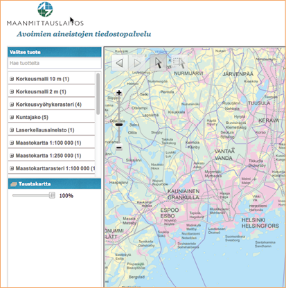
The open datasets can be downloaded cost-free from the National Land Survey’s download service. The user picks a product and specifies the desired format, coordinate system and area. After the selection, the service provides a web address from which the requested files can be downloaded.
http://www.maanmittauslaitos.fi/avoindata

17 September 1996 As the first official cartographic agency in the world, the National Land Survey opens MapSite, a web service offering maps of the entire country available for all to browse online.
January 2008 The National Land Survey begins to deliver its map resources free of charge to municipalities and researchers. By request of the Ministry of Finance, the agency returns to its former pricing policy.
2010 USeveral working groups are making plans for the opening of public data reserves. The guide for opening public data is published. The HRI project is launched.
March 2011 The Government makes a decision to promote the opening of public information.
April 2011 The National Land Survey begins to study the possibility of opening its map data.
June 2011 The opening of public information is included as a goal in the national government programme.
November 2011 The National Land Survey proposes a change to the decree on service charges. The Ministry of Finance budget department opposes the idea of distributing information free of charge.
December 2011 The Government approves the new decree despite the opposition.
January 2012 The National Land Survey launches its data-opening project.
1 May 2012 The map data is opened for free use by all.
•
The texts of the publication are licensed under the 'HRI-nimeä' attribution. All reuse of the material must be accompanied by the name of the author (Petja Partanen or Terhi Upola) and the publisher (Helsinki Region Infoshare).

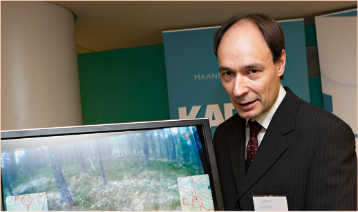
Antti Rainio who has been an advocate of open GIS data from 1980s, was chosen as the IT opinion leader of Finland in 2011.
Who made it happen?
Antti Rainio, Senior Expert,
National Land Survey
Antti Kosonen, Director, National Land Survey
Supplier National Land Survey
What did it cost?
Opening the data and building a download service took ”something like a few man-years”. ”We estimate the loss of sales revenue to be 1.5 million euro per year”, tells Antti Kosonen.
Tips for those planning to open their data
1. “Your own expertise will not disappear after unlocking data. On the contrary, it will be even more in demand”, says Antti Rainio.
2. Opening the data reveals the errors it may contain. ”That is a good thing since searching for them is very expensive otherwise”, states Antti Rainio.
3. Read the guidebook Public Data – an introduction to opening information resources. ”For me, it clarified the basic issues of open data”, Antti Kosonen tells.
What were your expectations from the data opening?
”New innovations will come into existence that are based on the innovative exploitation of different data sets” Rainio explains.
”Making better use of the data means getting better returns from our investments in producing the data reserves. Unlocking geodata might inspire people to enjoy nature in greater extent. One of the consequences may well be an improvement in national health”, says Antti Rainio ponders.
What concerns were there related to the opening?
”We were worried – unnecessarily, as it turned out – that no one would care about the licence restrictions. But when others shared our data as torrent files, they made it a point to clearly communicate the conditions related to the licence”, Antti Kosonen tells.
Another worry was that the customer service would be jammed up. ”The need for customer service has not grown, but the character of the job has changed. Before, it often involved compiling and sending datasets. Now the data can be obtained as self service, but the need for customer support is greater since the use of the data has increased 50 times”, defines Antti Kosonen who is responsible for the information services of the National Land Survey.
This is how the data was opened
Missä dataa käytetään?
Karttapullautin
Karttapullautin (“Map Maker”) is a free-of-cost program which allows anyone to create orienteering maps suitable for practice use from the Auto Scanning Laser System (ALS) resources of the National Land Survey with just a couple clicks of the mouse. Survey with just a couple clicks of the mouse.
http://apps4finland.fi/2012/09/10/sovellus-karttapullautin/
The digital terrain model of the National Land Survey was used to create the terrain for the film dramatising the story of Aarno Lamminparta, who hijacked an airplane in 1978..
Creator of Karttapullautin
Jarkko Ryyppö.
Licence CC BY 3.0. Photographer Olli-Pekka Orpo

